

Houston weather: Storms possible through the weekend
Houston weather: Rain chances through start of next week
Our pattern will remain primed for showers and storms through at least Monday and possibly Tuesday.
Slight chances of ‘excessive rain’
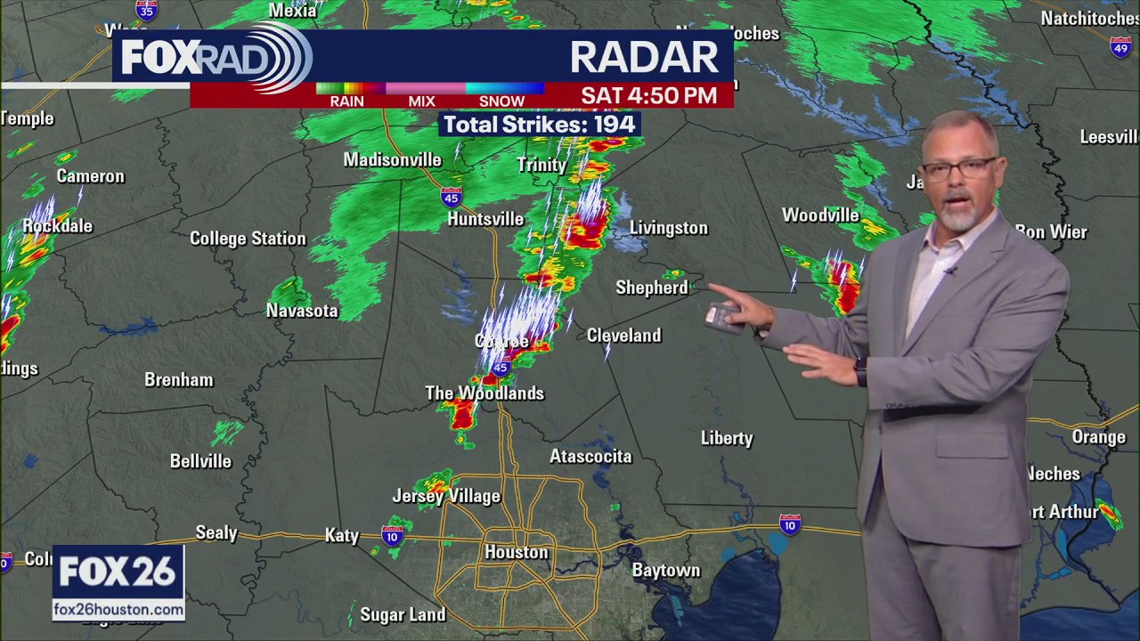
HOUSTON - As storms pop up this afternoon, watch for a few that could drop 2-3" of rain.
Storms should initially be fast movers, but could slow down by later in the day and get a bit heavier.
A Flood Advisory is in effect for Montgomery County this evening.
Unsettled Sunday and Monday

Our pattern will remain primed for showers and storms through at least Monday and possibly Tuesday, so watch for occasional heavy storms with very warm and humid air in between.
Getting hot and watching the Gulf

Tropical Weather Update - July 12, 2025
Things are starting to look favorable for a tropical cyclone to form in the Gulf this week. A weak area of broad low pressure should form near Florida towards the middle or end to the week.
Conditions look favorable for highs in the mid to upper 90s by the middle of next week in the Houston area with heat index values between 100-105 during the day.
Although models are not showing any intense tropical systems at this point, we will be closely watching the Gulf closer to Florida where a weak area of low pressure could form by the middle of next week - not impossible that a depression could form, so just stay tuned.
The Source: Your Gulf Coast Weather Authority